Size, Scale, and LocationSierra Leone is a country located in the upper west area of Sub-Saharan Africa. It takes up 27,699 square miles of land (about half the size of Louisiana) and is bordered by Guinea, Liberia, and the Atlantic Ocean.
Physical FeaturesThe coastal Guinean mangroves, eastern mountains, upland plateaus, and wooded hill country make up Sierra Leone's four geographical regions. The lowest point of Sierra Leone is its coastline, which is zero meters above sea level, but its highest point is a mountain named Mount Bintumani, which is 1,945 meters above sea level.
ClimateThe average temperature is Sierra Leone is 81°F. Sierra Leone has a dry season from December to May and a rainy season from May to November. Its dry season comes from wind blowing off of the Sahara desert.
Environmental IssuesSierra Leone is a country that suffers from deforestation (cutting down forests), degradation (loss of density of vegetation), and land and water polution. Some towns, like Freetown, have flooding issues.
ResourcesSierra Leone is known for its resources, mainly its diamonds. Sierra Leone, however, also produces gold, bauxite, iron, rutile, and limonite. Diamond mining in Sierra Leone has lead to conflict (most notably civil war), and most proceeds from diamonds don't go to the country's government or its people, they go to private businesses or corrupt officials.
Major LandmarksThe Loma Mountains, Tiwai Island, Lake Safron, Sierra Leone River, and Tingi Hills Forest reserve all all major locations in Sierra Leone.
|
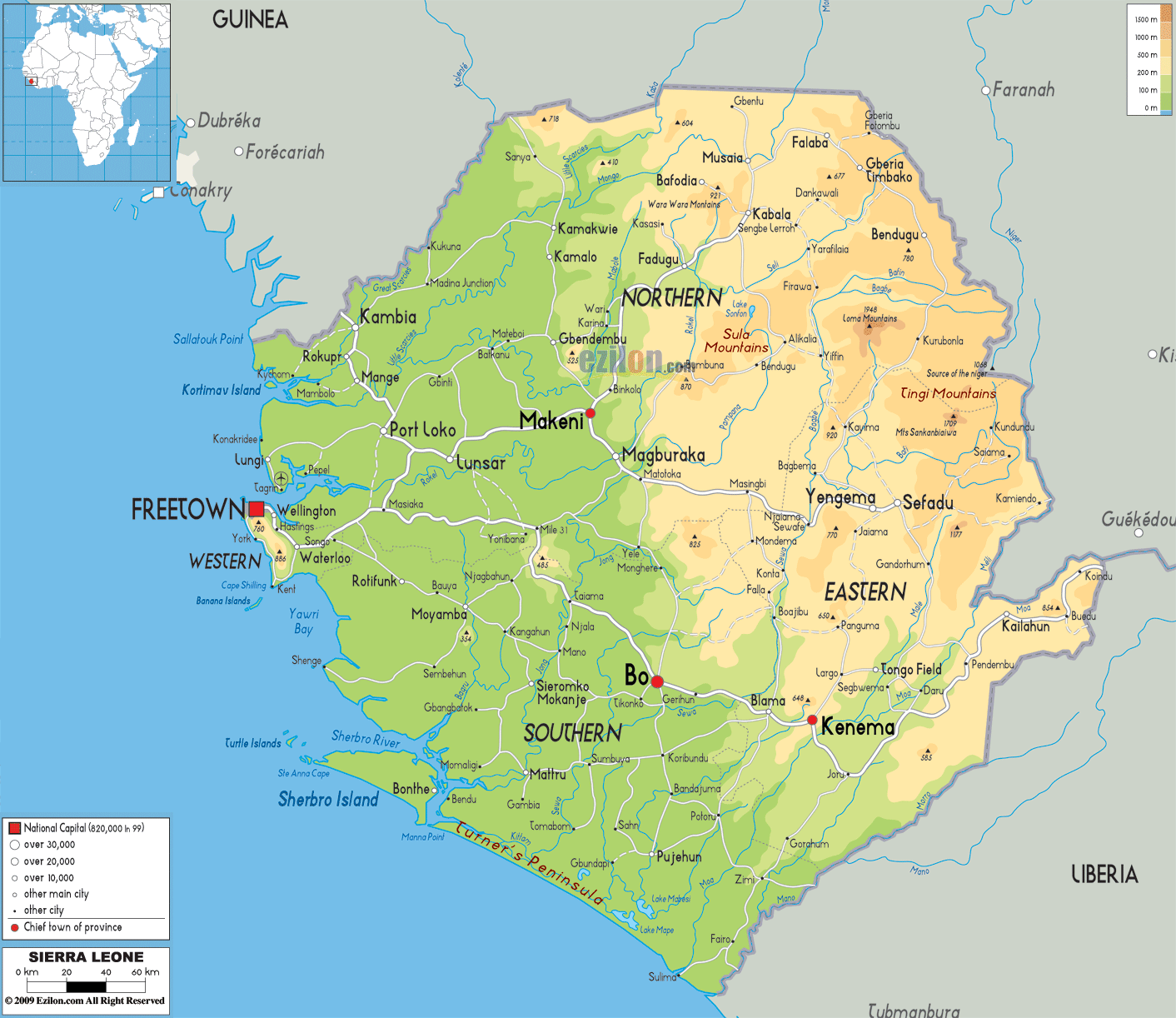
Pictured above: physical map of Sierra Leone
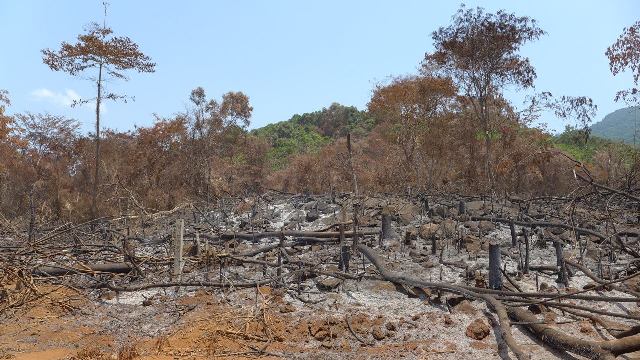
Pictured above: deforestation in Sierra Leone

Pictured above: diamond mining in Sierra Leone
|
